Rangamati District
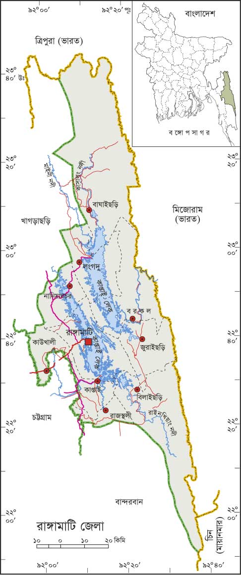
Rangamati is a district of immense natural beauty and rich cultural heritage. Located between 22°00'27" to 23°00'44" N and 91°00'56" to 92°00'33" E, it is bordered by Tripura (India) to the north, Bandarban to the south, Mizoram (India) to the east, and Khagrachari and Chattogram to the west. The district comprises ten Upazilas, two Pourashavas, and forty-nine Unions. Rangamati is the largest district in Bangladesh by area and is unique for its hilly topography, which means there are no rickshaws in the town. The region boasts a diverse cultural tapestry, home to both Bengali and indigenous communities, including the Chakma, Marma, Tripura, Tanchangya, Mro, Pankua, Chak, Khiang, Khumi, and Lushai. While the majority of the Bengali population is Muslim, the indigenous communities are predominantly Buddhist, with significant Hindu and Christian populations. Rangamati Pourashava was established in 1972, followed by Baghaichari Pourashava in 2004. As a premier tourist destination, Rangamati attracts thousands of local and international visitors annually. Key attractions include Kaptai Lake (the largest man-made lake in South Asia), the Hanging Bridge (Jhulonto Bridge), Shuvolong Waterfall, Rajban Vihara, the Chakma Rajbari, and the Tribal Cultural Institute. Visitors also enjoy scenic drives along the Kaptai-Rangamati road and the panoramic views from Furman Peak. The district is also famous for its hydraulic power plant at Kaptai, the Betbunia Satellite Earth Station, and its fresh produce like cashew nuts, watermelons, and local bananas.