Gaibandha District
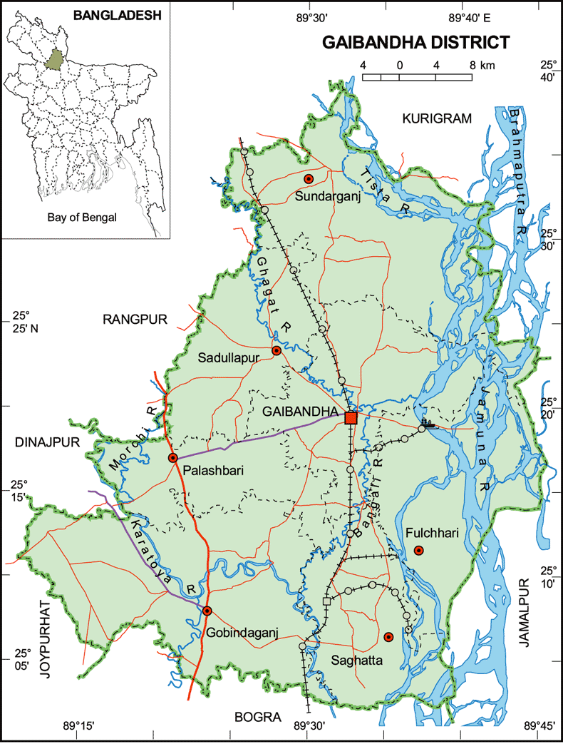
Gaibandha district stands on the bank of the river Jamuna (Brahmaputra) and is located between 25°03'00"N - 25°39'00"N and 89°12'00"E - 89°42'00"E. It consists of 7 upazilas, 3 municipalities, and 82 unions. Bhabanigonj Sub-division was created on 27th August 1858 under the then Rangpur district. However, Bhabanigonj Sub-division was eroded by river erosion in 1875, and the headquarters was shifted to Gaibandha. Consequently, the sub-division was renamed as Gaibandha. It is surrounded by the Teesta river, Rangpur, and Kurigram districts in the north, Bogra in the south, Rangpur, Dinajpur, and Joypurhat in the west, and the Brahmaputra river in the east. Gaibandha was upgraded to a district on 15th February 1984. The economy is primarily based on agriculture, and it has become one of the food surplus districts. Additionally, a considerable portion of livelihood is based on fishing, service, and small-scale cottage industries. Rangpur Sugar Mill, located at Mohimagonj, is also famous in the northern region. The communication system has enormously developed in the last three decades. Prominent rivers include the Brahmaputra, Teesta, Karatoya, Bangali, and Ghaghot, making flood and river erosion common phenomena in the lives of the people here.