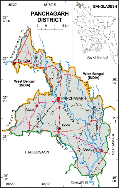
Panchagarh District
The existence of five 'garhs'—Bhitargarh, Hosaingarh, Mirgarh, Rajangarh, and Devengarh—gave Panchagarh its name. The city stands on the bank of the Karatoya river and is located at 24.90°N 88.75°E. Panchagarh is the northernmost district of Bangladesh, bounded on three sides by a 288 km long Indian border, with Darjeeling to the north, Jalpaiguri and Cooch Behar to the northeast, West Dinajpur and Purnia to the west, Dinajpur and Thakurgaon to the south, and Nilphamari to the east. Panchagarh was a thana under Jalpaiguri district during British rule and became part of Dinajpur after the 1947 partition. It was turned into a subdivision in 1980 and elevated to a district on 1st February 1984. It consists of five upazilas, two municipalities, 43 union parishads, and 850 villages. Panchagarh has a rich history and heritage, including the culture of indigenous Santal people. The Panchagarh Municipality was established in 1985. Panchagarh Sugar Mills, the northernmost in Bangladesh, was set up between 1965 and 1969. The first Rocks Museum in Panchagarh was established in 2000. Noted institutions include the Panchagarh BP Government High School (1944) and the Primary Teacher Training Institute (2006). The soil is sandy and alluvial, bearing a close affinity with the old Himalayan Basin. The district is home to 16 rivers, including the Karatoya, Atrai, Teesta, Nagor, Mahananda, and Tangon. Industries such as tea estates, sugar mills, and jute mills play a vital role in its economy.